Walking City Histories: Finding the Past in Every Sidewalk Crack

This post teaches you how to read a city's history through its buildings, street patterns, and public spaces—turning an ordinary walk into an immersive lesson in urban evolution. You'll learn practical techniques for spotting architectural layers, understanding how historical events shaped neighborhoods, and connecting the physical environment to the stories of people who lived there centuries ago.
What Can Old Buildings Tell You About a City's Past?
Every building is a time capsule—if you know what to look for. Start with the facade. Ornate cornices and decorative moldings often signal 19th-century prosperity, when industrial wealth funded elaborate stonework. Plain, repetitive windows arranged in grid patterns? You're likely looking at post-war reconstruction or utilitarian housing from the 1950s and 60s. The materials matter too—local stone suggests pre-railroad construction, while identical brickwork across multiple buildings hints at mass production and standardized building codes that arrived with modernization.
Pay attention to what's missing. A sudden gap between two historic structures might mark where a building was bombed during wartime—or demolished for a highway that was never completed. Cities like Berlin and Warsaw wear these scars openly, with modern infill construction sitting awkwardly between pre-war survivors. In London, look for the distinctive orange-red brick of buildings erected after the Great Fire of 1666, when new regulations required fire-resistant materials.
Don't ignore the ground floor. Commercial spaces that have housed shops for centuries often retain wide entrances designed for horse-drawn carts—or narrow doorways that predated modern accessibility standards. A bar with stained glass and ornate woodwork probably started life as a Victorian gin palace. A cafe tucked into a converted bank vault still displays the heavy brass fixtures and marble counters from its financial past. These layers aren't accidents—they're evidence of economic shifts, changing social habits, and the constant reinvention that keeps cities alive.
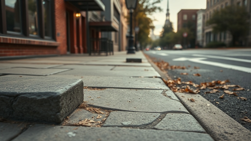
How Do Street Layouts Reveal a City's Age and Purpose?
Street patterns don't lie. Medieval cities grew organically around cathedrals, markets, and defensive walls—resulting in winding lanes that follow no logic except foot traffic and livestock movement. Walk through the Gothic Quarter in Barcelona or the Centro Storico in Rome and you'll find streets that bend unexpectedly, widen into irregular squares, or dead-end at ancient church walls. These weren't planned—they accumulated over centuries as people built where they could, following property lines and topographical constraints.
Contrast this with the rigid grids of colonial cities or 19th-century expansion districts. Philadelphia's numbered streets reflect Enlightenment ideals of order and rationality. Manhattan's famous grid was imposed on farmland in 1811, erasing existing property boundaries to create maximum developable lots. When you walk these streets, you're experiencing an ideology—faith in geometry, commerce, and growth that defined an era.
Then there's the modernist intervention: highways cutting through neighborhoods, pedestrian plazas created by closing streets to traffic, waterfronts transformed from industrial zones to recreational spaces. These changes tell you what the city valued at different moments—efficiency over community, commerce over manufacturing, leisure over production. The post-war highway boom in American cities destroyed countless historic neighborhoods in the name of progress. European cities often resisted these pressures, preserving their centers while pushing traffic underground or around the perimeter.
Why Do Some Neighborhoods Feel Different from Others?
The character of a district emerges from its economic history. Port neighborhoods—like Liverpool's Albert Dock or Rotterdam's Kop van Zuid—carry the DNA of maritime trade: wide streets for moving goods, warehouses with loading bays, pubs that served sailors. When shipping moved to container ports outside city centers, these areas often declined—then reinvented themselves as entertainment districts, preserving their industrial architecture while replacing cargo with cafes.
Manufacturing zones tell similar stories. The cast-iron buildings of New York's SoHo were built for textile workshops that needed daylight and sturdy floors for heavy machinery. When manufacturing moved overseas, artists moved in—drawn by cheap rent and large windows. The galleries followed, then the boutiques, then the tourists. Today you're walking through a luxury shopping district that happens to look like a 19th-century factory complex.
Religious and institutional history shapes neighborhoods too. Areas around universities develop distinctive rhythms—academic calendars, student housing patterns, bookshops and coffee cultures that persist for generations. Catholic cities often feature monastery districts where religious orders built self-contained communities with their own rules and economies. Jewish quarters—whether the preserved judería in Toledo or the former Lower East Side of Manhattan—reveal both vibrant community life and the darker history of segregation and persecution. These spaces hold memory in their stones.
How Can You Research a City's History While Walking It?
You don't need a PhD to read the built environment—you need curiosity and a few practical tools. Start with historical maps. Many cities digitize old fire insurance maps, cadastral surveys, and planning documents. Compare a 19th-century map to modern satellite imagery and you'll spot what's disappeared: vanished canals, filled-in harbors, demolished fortifications that once defined the city's shape.
Plaque hunting rewards patient observation. Historical markers—whether official blue plaques or informal memorials—reveal the specific events that happened on the spot where you stand. Birthplaces of forgotten writers. Sites of labor strikes. Buildings where treaties were signed. These aren't just trivia—they're entry points into larger stories about political movements, economic systems, and cultural shifts that shaped the modern world.
Local archives and municipal museums often offer walking tour brochures or audio guides that connect physical locations to historical narratives. The Brisbane City Walk in Australia threads 40 heritage sites through the modern downtown, explaining how convict labor, gold rushes, and 20th-century redevelopment created the city you see today. Similar trails exist in hundreds of cities—you just need to look for them.
What Should You Notice in Public Spaces and Monuments?
Statues and memorials aren't permanent fixtures—they're historical arguments frozen in bronze and stone. Ask yourself: Who paid for this? What message were they promoting? The grand equestrian statues of colonial administrators that dominate squares from Delhi to Lima proclaimed imperial permanence. Many have been removed or recontextualized as perspectives shifted. Empty plinths tell their own stories about political transformation.
Cemeteries function as outdoor museums of social history. The size of monuments reflects wealth inequality. The languages on tombstones trace immigration patterns. Epidemics appear in clusters of death dates—cholera outbreaks, influenza pandemics, wartime casualties. The shift from churchyard burial to suburban garden cemeteries in the 19th century reflected changing attitudes toward death, hygiene, and urban planning. Père Lachaise in Paris or Highgate in London reward hours of exploration.
Public markets reveal economic relationships between city and countryside. Permanent market halls with cast-iron structures—like Budapest's Great Market Hall or Florence's Mercato Centrale—represented municipal investment in food security and public health during the industrial era. Their architecture celebrates abundance and civic pride. Meanwhile, informal street markets that appear weekly or seasonally maintain older patterns of trade that predate permanent retail. Watch what's being sold, who's selling it, and how customers interact. You're witnessing economic history in real time.
Walking a city with historical awareness transforms tourism into discovery. You stop seeing buildings as backdrops for photos and start recognizing them as evidence—of political decisions, economic forces, technological changes, and human choices that accumulated over centuries. The sidewalk you're walking on might overlay a Roman road. The coffee shop occupying a former bank vault maintains architectural features designed to project stability and trust. The park created from a demolished neighborhood represents both loss and renewal.
This approach doesn't require exhaustive preparation—just attention to detail and willingness to ask questions. Why does this street curve? What's that odd structure on the roof? Why are the buildings taller on this block? Each question opens a door into the past. The city becomes a text you can read, layer by layer, revealing stories of ambition and failure, innovation and tradition, destruction and preservation that shaped the urban world we inhabit today.
"The city is a poem, and the flâneur is its reader—walking slowly enough to hear the verses spoken by stone and steel."
Your next walk through an unfamiliar neighborhood—or a familiar one seen with fresh eyes—can become an archaeological expedition. Bring a camera to document architectural details. Take notes on street names (they often commemorate forgotten events). Sketch the relationship between buildings and public spaces. The history is there, waiting to be noticed. You just need to slow down and look.